
Join Us For A Walk

The cost of joining a walk is £1.50 for members of the Centre and £2.00 for visitors. It is not necessary to pay in advance for a walk – simply follow the joining instructions, meet at the designated car park, at least 10 minutes before the walk is due to start, and pay on the day.
However, to ensure that the organiser knows that you are coming and can let you know if there are any last minute changes of plan, you should always book in advance, giving your name and contact details. If you want to join us for lunch, it is often necessary to advise the organiser anyway, so that the pub can be forewarned. See walk description for details.
If you don’t feel up to the walk itself, but would like to join the walkers for lunch at the pub, just mark your booking as Lunch Only and check with the organiser about arrangements for letting them know your menu choices.
Select Read More to display walk details on a small screen
2026 Walks programme
Christmas At The Rag 3m - Thursday 10th December

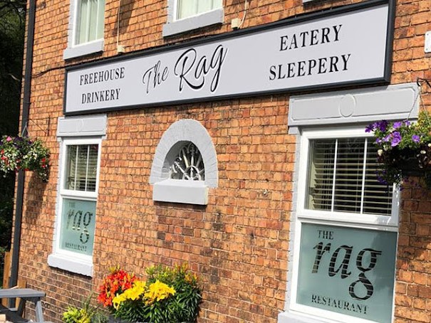
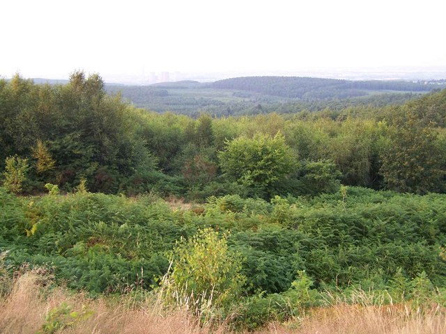
Our traditional Christmas stroll around Castle Ring, followed by Christmas lunch at the Rag is an excellent way to meet up with fellow members. The optional walk has some steady climbs, but no stiles. It begins with an uphill stretch along a quiet lane, before turning off into a wooded area. We then connect with the “Heart of England Way”, and follow this to Castle Ring to see the far-reaching views over the Staffordshire countryside.
Please wear suitable footwear as it will almost certainly be muddy. Back to an earlier start for the walk, we have been asked by the restaurant, to be back by 11.45 to be seated, and ready to eat by 12.00.
Start: 10.15. The Rag car Park for a 10.30 start.
Sat Nav: WS12 0QD.
Organiser: Nigel Holmes/John Willis
Booking deadline: Saturday 6th December.
Please note: To book this walk and lunch at The Rag, only use the Book The Rag button.
Our traditional Christmas stroll around Castle Ring, followed by Christmas lunch at the Rag is an excellent way to meet up with fellow members. The optional walk has some steady climbs, but no stiles. It begins with an uphill stretch along a quiet lane, before turning off into a wooded area. We then connect with the “Heart of England Way”, and follow this to Castle Ring to see the far-reaching views over the Staffordshire countryside.
Please wear suitable footwear as it will almost certainly be muddy. Back to an earlier start for the walk, we have been asked by the restaurant, to be back by 11.45 to be seated, and ready to eat by 12.00.
Start: 10.15. The Rag car Park for a 10.30 start
Sat Nav: WS12 0QD.
Organiser: Nigel Holmes/John Willis
Booking deadline: Saturday 6th December
Please note: To book this walk and lunch at The Rag, only use the Book The Rag button.
Burston & Aston – 4.8m - Wednesday 14th October (with shorter, 2.4m option)
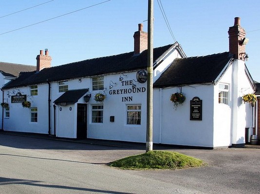

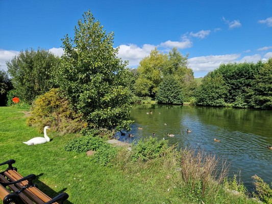

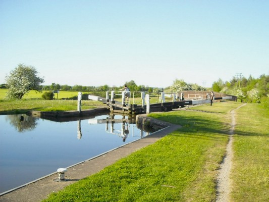
This is another virtually flat walk with just one stile (to access the Trent & Mersey canal towpath on the outward leg).
Starting from The Greyhound Inn at Burston we walk through the picturesque village of Burston, before joining the canal towpath. See if you can spot the milepost that marks the halfway point on this canal (which is over 90 miles in length). After passing Aston Marina and Aston Lock, we join the Two Saints Way, stopping at St. Saviours Church, where the people that opted to do the shorter walk will join us at around 11:30. After passing Aston Hall, we follow the track that joins the two halves of Aston-By-Stone, before crossing the fields and marshland (via duck boards); an area popular with bird spotters. We then cross the Trent via the newly rebuilt bridge, before returning via Burston to the Greyhound for lunch.
Meet: 09:45 in The Greyhound car park for a 10:00 start (toilets available).
Sat Nav: ST18 0DR
Shorter walk: Meet in St. Saviours churchyard (park on the right of the drive), ready to depart around 11.30.
Sat Nav: ST15 0BJ W3W: ///danger.eagle.pounces
Terrain: Easy walking on the whole, but the canal towpath is uneven in some places as is the path across the fields. Quiet roads with very little traffic but no footpaths, so please walk single file on the right-hand side.
Lunch: 13:00. Please let us know if you will be joining us for lunch and let Nigel know your menu choices by Monday 12th October.
Organiser: Nigel Holmes
This is another virtually flat walk with just one stile (to access the Trent & Mersey canal towpath on the outward leg).
Starting from The Greyhound Inn at Burston we walk through the picturesque village of Burston, before joining the canal towpath. See if you can spot the milepost that marks the halfway point on this canal (which is over 90 miles in length). After passing Aston Marina and Aston Lock, we join the Two Saints Way, stopping at St. Saviours Church, where the people that opted to do the shorter walk will join us at around 11:30. After passing Aston Hall, we follow the track that joins the two halves of Aston-By-Stone, before crossing the fields and marshland (via duck boards); an area popular with bird spotters. We then cross the Trent via the newly rebuilt bridge, before returning via Burston to the Greyhound for lunch.
To see a map of the route and details of the Burston – Aston Trail from Staffordshire Wildlife Trust, click here.
Meet: 09:45 in The Greyhound car park for a 10:00 start (toilets available).
Sat Nav: ST18 0DR
Shorter walk: Meet in St. Saviours churchyard (park on the right of the drive), ready to depart around 11.30.
Sat Nav: ST15 0BJ W3W: ///danger.eagle.pounces
Terrain: Easy walking on the whole, but the canal towpath is uneven in some places as is the path across the fields. Quiet roads with very little traffic but no footpaths, so please walk single file on the right-hand side.
Lunch: 13:00. Please let us know if you will be joining us for lunch and let Nigel know your menu choices by Monday 12th October.
Organiser: Nigel Holmes
Brewood- Weston– 4m –Wednesday 23rd September




This event is now closed
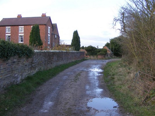
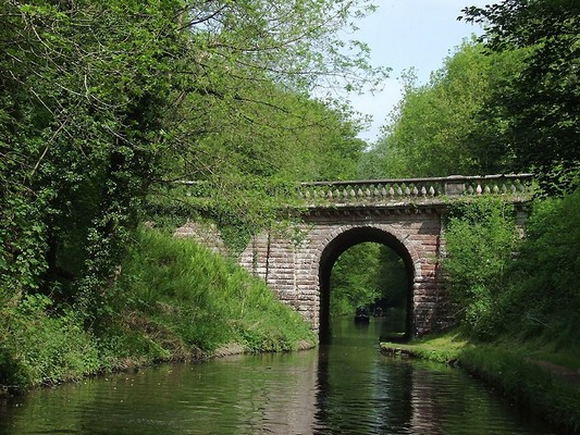
This is a relatively flat walk with no stiles – mainly across fields, wooded areas and along the towpath of the Shropshire Union canal, although there is a country road to cross and a short section on quiet country lanes with traffic, so care will be required.
We start from the cross roads at the centre of Brewood and walk past the church, through a small alleyway to the Shropshire Union Canal which we cross using Dean’s Hall Bridge. At this point we pick up a section of the Staffordshire Way and follow this to Woolley Farm. We continue on the Staffordshire Way across fields until we cross the Upper Avenue which gives a view of Chillington Hall.
A little further on we leave the Staffordshire Way and head along a track and a paved country lane where we turn northwards until we again reach The Avenue we continue along the Lower Avenue until we reach Avenue Bridge and rejoin the Shropshire Union Canal.
We then walk north along the canal tow path and return to Dean’s Hall Bridge and Brewood.
Terrain: Flat, no stiles but some sections may be boggy after rain, so walking boots are recommended.
Meet: 9.45 for a 10.00 am start at the cross roads at the centre of Brewood. Some car parking is available behind the Co-op (access from Stafford St) and along the road in front of the church.
Sat Nav: Co-op, 2 Market Place is ST19 9BS,
Lunch: 1.00 pm at The Three Stirrups, 1 Engleton Lane, Brewood, Sat Nav: ST19 9DZ
Parking is available at the pub for those who are joining us for lunch. Please let Bob know if you going to the lunch by Monday 21st.
Organiser: Bob Whitehouse
Norbury Junction– 4.5m –Thursday 13th August (with an easier short distance option)




This event is now closed
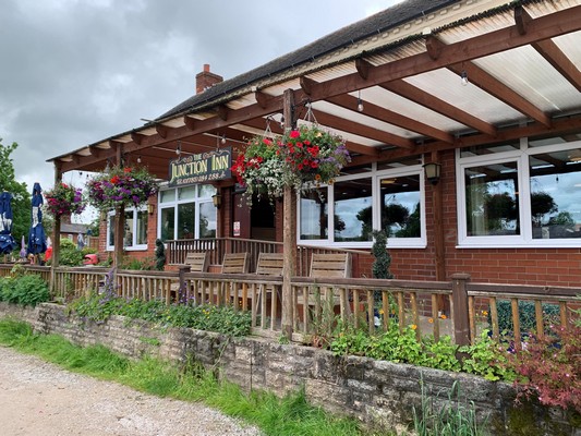
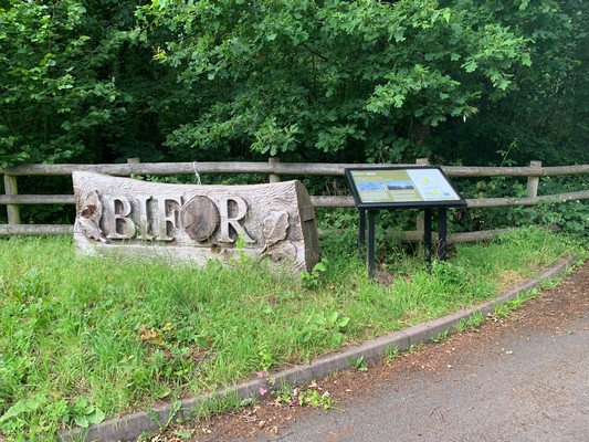
This figure of eight walk, starts and finishes at the Junction Inn, adjacent to the Shropshire Union canal. The pub doesn’t open until 12:00, but if you need to access a toilet on arrival, you can use the facilities at the Wharf Tea Room (over the bridge on the opposite side of the canal), providing that you make a small purchase from the tea room or shop.
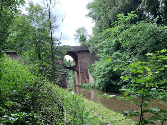
We should complete the first loop before midday, so if you want a shorter walk, you can get a drink at the tea room, before returning to the Junction Inn for lunch. The route is mainly flat, on dirt tracks and quiet roads with one stile, two short steep inclines, one tunnel (about 20 yds long) and a short section of main road.
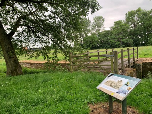
The second loop continues along the towpath, under the canal bridge, then after approximately ½ a mile there’s a steep incline adjacent to ‘High Bridge’, leading to the A519, opposite Loynton Moss. We then need to cross the bridge carefully (no footpath) facing the oncoming traffic, and paying attention to Cathy’s instructions. We then follow a dirt track, between fields and young woodland, to meet a surfaced track where we turn right. After a hundred yards or so we’ll pause to look at the remains of the historic moated manor, eventually returning via a short flight of steps, back up to the canal bridge, for a well-deserved lunch.
After lunch, if anyone would like to look at the historic church on the way home, please let Cathy know, and she will try to arrange to open it for us.
Meet: in the Junction Inn car park at 09:45, ready to depart by 10:00.
Sat Nav: ST15 0RA – W3W: ///trendy.operating.overtones
Terrain: Mixed (as described above) – boots or strong shoes recommended for the second loop.
Lunch: 13:00. Please let Cathy have your menu choices by Monday 10th August.
Organiser: Cathy Evans.
This figure of eight walk, starts and finishes at the Junction Inn, adjacent to the Shropshire Union canal. The pub doesn’t open until 12:00, but if you need to access a toilet on arrival, you can use the facilities at the Wharf Tea Room (over the bridge on the opposite side of the canal), providing that you make a small purchase from the tea room or shop.
We should complete the first loop before midday, so if you want a shorter walk, you can get a drink at the tea room, before returning to the Junction Inn for lunch. The route is mainly flat, on dirt tracks and quiet roads with one stile, two short steep inclines, one tunnel (about 20 yds long) and a short section of main road.
The second loop continues along the towpath, under the canal bridge, then after approximately ½ a mile there’s a steep incline adjacent to ‘High Bridge’, leading to the A519, opposite Loynton Moss. We then need to cross the bridge carefully (no footpath) facing the oncoming traffic, and paying attention to Cathy’s instructions. We then follow a dirt track, between fields and young woodland, to meet a surfaced track where we turn right. After a hundred yards or so we’ll pause to look at the remains of the historic moated manor, eventually returning via a short flight of steps, back up to the canal bridge, for a well-deserved lunch.
After lunch, if anyone would like to look at the historic church on the way home, please let Cathy know, and she will try to arrange to open it for us.
Meet: in the Junction Inn car park at 09:45, ready to depart by 10:00.
Sat Nav: ST20 0PN – W3W: ///trendy.operating.overtones
Terrain: Mixed (as described above) – boots or strong shoes recommended for the second loop.
Lunch: 13:00. Please let Cathy have your menu choices by Monday 10th August.
Organiser: Cathy Evans.
Swynnerton – 3.6m – Wednesday 1st July
This event is now closed
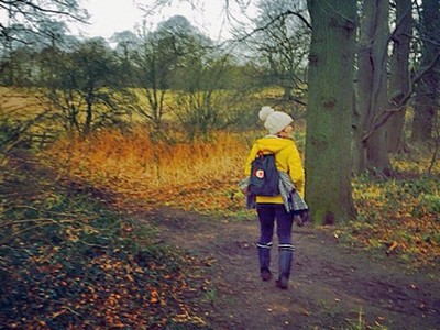
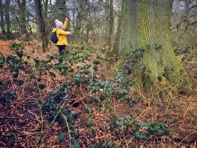
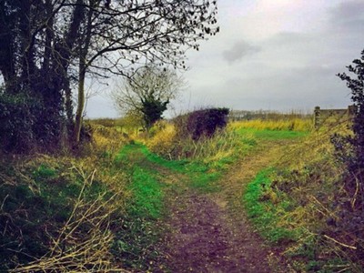
This circular walk starts and finishes at the Fitzherbert Arms. The car park is at the rear, and there’s more parking outside the nearby village hall (Early Lane), if the pub car park is full.
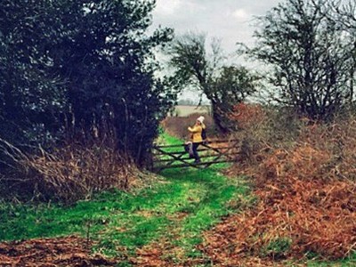
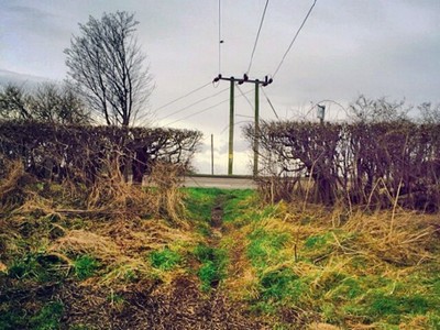
The route consists of mainly off-road footpaths, with a few well-maintained stiles on the last section and one of the green footpaths is slightly overgrown, but passable with care (however, shorts are not recommended).
Meet: in the Fitzherbert Arms car park at 10:15, ready to depart by 10:30
Sat Nav: ST15 0RA – W3W: ///wings.trend.train
Terrain: Some uneven paths, so boots or strong shoes recommended.
Lunch: 13:00 (approx.) Please let Judith have your menu choices by Monday 29th June
Organiser: Judith Carder
Carsington Water & Hognaston – 4.2m – Thursday, 18th June


This event is now closed
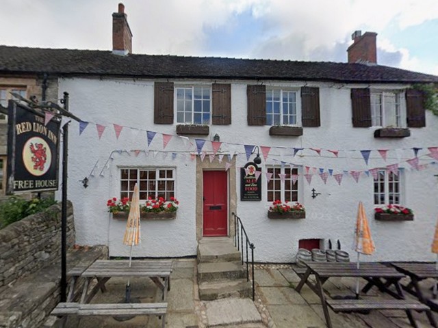
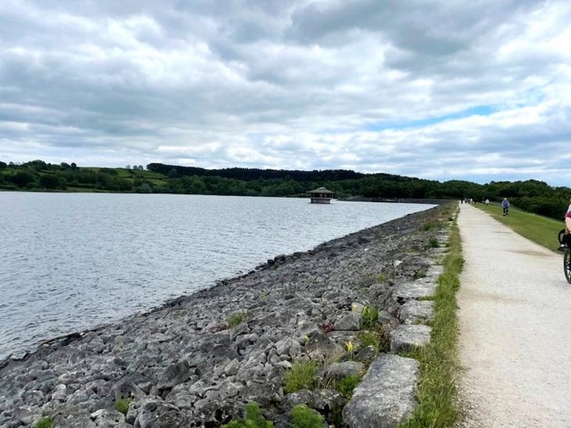
Note rescheduled date. This circular walk starts and finishes at the Red Lion in Hognaston, and includes a visit to Stones Island, plus a walk along the length of the dam, which was built in the 90s, to create Carsington Water. It took 10 years to build and when full, it holds around 7.8 billion gallons of water, making it the ninth-largest reservoir in England.
Those wanting a short walk, can park at Carsington Water, and visit Stones Island (Note: parking charges apply). Toilets and refreshments are also available at the Visitor Centre, and these areas are fully accessible. To see a map of the route click here


Start: Red Lion Inn Car Park, Hognaston at 09:45, ready for a 10:00 start (toilets will be available on arrival).
Terrain: If you intend to do the full walk, please wear boots or strong shoes, as some of the walk is across fields and uneven ground. There are also a small number stiles to negotiate (including a few Derbyshire ‘squeeze stiles’).
Sat Nav: DE6 1PR – allow at least one hour for the journey. Parking spaces are limited, so if you can car share (offer a lift or accept one), that would be helpful (please let us know, using the Contact Us form – link at the bottom of this page).
Lunch: The Red Lion Inn, at 13:00. Sample Menu (no need to pre-order).
Organiser: Nigel Holmes
Note rescheduled date. This circular walk starts and finishes at the Red Lion in Hognaston, and includes a visit to Stones Island, plus a walk along the length of the dam, which was built in the 90s, to create Carsington Water. It took 10 years to build and when full, it holds around 7.8 billion gallons of water, making it the ninth-largest reservoir in England.
Those wanting a short walk, can park at Carsington Water, and visit Stones Island (Note: parking charges apply). Toilets and refreshments are also available at the Visitor Centre, and these areas are fully accessible. To see a map of the route click here
Start: Red Lion Inn Car Park, Hognaston at 09:45, ready for a 10:00 start (toilets will be available on arrival).
Terrain: If you intend to do the full walk, please wear boots or strong shoes, as some of the walk is across fields and uneven ground. There are also a small number stiles to negotiate (including a few Derbyshire ‘squeeze stiles’).
Sat Nav: DE6 1PR – allow at least one hour for the journey. Parking spaces are limited, so if you can car share (offer a lift or accept one), that would be helpful (please let us know, using the Contact Us form – link at the bottom of this page).
Lunch: The Red Lion Inn, at 13:00. Sample Menu (no need to pre-order).
Organiser: Nigel Holmes
Stone Town – 4.8m – Wednesday, 25th March
This event is now closed
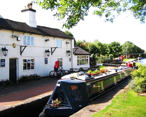
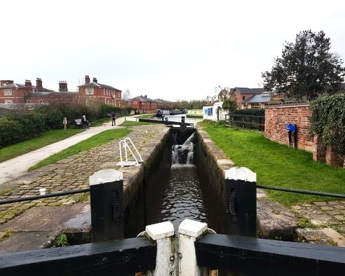
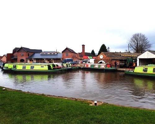
The walk will start and finish at the Star Inn. We begin by passing under the road to Westbridge Park, and eventually join the Trent & Mersey Canal towpath, which we follow past the town, and up to Meaford Locks. Here, we pick up a footpath towards Outlanes and the Common Plot. The route then takes us around Alleynes High School, before crossing the A520 to Nanny Goat Lane and returning to The Star, via St Michaels churchyard.
There’s plenty of history associated with Stone, so we’ll pause to look at things of interest along the way… for example, we’ll take a look at the historic Joules brewery buildings, the new Crown Wharf, and the old buildings at the end of Mill Street (associated with milling flint for the potteries and flour for Hovis bread).
The route consists of towpaths and public footpaths, with just two well-maintained stiles (one with a gate alternative) and, of course, we’ll stop for a coffee break. Boots or strong shoes/trainers recommended.
Start: 9.45am at the Star Inn Car Park, to depart at 10.00am. As the pub won’t be open at this time, public toilets are located just around the corner, in Crown Street Car Park. We should be back for lunch by 1.00pm.
Sat Nav: ST15 8QW (nearest). Approach via the A34 (follow the signs to Stone). The entrance to the Star Inn car park is on Stafford Street (opposite M&S).
Lunch: The Star Inn, 21 Stafford Street, Stone, ST15 8QW. If you wish to join us for lunch, then please let Nigel have your menu choices by Monday 23rd March
Organiser: Nigel Holmes